Thursday, July 23, 2026
News and Views from the Global South

CHILE: Cracks Exposed in Readiness Plan
Daniela Estrada* - Tierramérica
- Inadequacies in technical equipment, specialised human resources, institutional coordination, land zoning and citizen awareness were all laid bare by the major earthquake and subsequent tsunami on Feb. 27 in central and southern Chile.

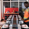
Searching through the rubble in Ojos del Mar, a tourist destination in the Valparaíso region of Chile that was hit by the tsunami. Credit: Fernando Fiedler/IPS
“That is one of the major lessons that we must learn,” Campos said.
The seismologist, along with other Chilean and foreign scientists, in the early 1990s detected two “seismic gaps” in which earthquakes of great magnitude could occur due to the interaction of the South American and Nazca tectonic plates, whose border runs through Chilean territory.
The latest publication of data about this was released in 2009.
It is precisely one of these “mature” zones – in seismological terms – that encompassed the central cities of Constitución and Concepción, where the February quake was most intensely felt, reaching 8.8 on the Richter scale.
The temblor triggered a tsunami that swept through several coastal towns in the regions of El Maule and Bío-Bío, located 200 to 500 kilometres south of Santiago, the capital of a country that is accustomed to praise as one of the most advanced in Latin America in terms of economic and social development.
Following the quake, which claimed 500 lives and left thousands of homes in rubble, mistakes and poor coordination between the naval Hydrographic and Oceanographic Service (SHOA) and the National Office of Emergencies (ONEMI) meant a delay in issuing a tsunami alert to protect the population.
ONEMI attributed the government’s slow response to a breakdown in the communications network resulting from the quake.
Campos acknowledged that “An earthquake of magnitude 8.8 puts any emergency system in extreme tension and hurts its ability to react. The damage zone was enormous, nearly 500 kilometres, and severely affected all of the country’s communicational support.” He also pointed out that Chile is one of the world’s countries with the most seismic activity.
Research by scientific institutions in the United States and Chile indicates that the force of the tremor shifted Concepción more than three metres to the west. Also moved were Santiago (27.7 centimetres) and the Argentine cities of Mendoza (13.4 cm) and Buenos Aires (2 to 3.9 cm).
Campos said that better technological infrastructure and, especially, a critical mass of scientists could have mitigated the damage caused by the second strongest earthquake suffered by this country, the first being the 1960 quake that registered 9.5 on the Richter scale in the southern city of Valdivia.
The national Seismological and Volcanic Network, created as part of this year’s bicentennial celebrations of independence from Spain, is to begin full operations in 2012.
Meanwhile, ONEMI has undergone a modernisation process in recent years, which proved insufficient, however.
“There is a notable lack of experts and specialists” able to operate the new technology that is available and to disseminate their knowledge among decision-makers, the educational system and the population of 17 million, said Campos.
“This is a problem common throughout Latin America, because our countries set aside few resources for the training of that kind of expert human capital,” which is costly and provides few political benefits in the immediate term, he said.
However, the western stretch of South America is highly exposed to natural catastrophes like earthquakes, volcanic eruptions and tsunamis.
In the area of technology, Campos underscored the experience of Japan, which “has a network of sensors throughout its national territory, connected in real time to a strong communication system, which does not collapse as a result of earthquakes.”
The information generated by those sensors “is channelled through a central processing point, where in a few seconds it identifies zones in which there have been severe ground movements and where the areas of maximum damage are located,” he explained.
If Chile had a system like this, it could have meant less time in discovering all of the sites in the country affected by the earthquake and the tsunami.
According to Campos, the information that SHOA utilised, generated by a system of buoys set up by the United States in the Pacific Ocean to measure changes in wave action, is not the most appropriate for this region.
“Countries of Latin America, like Peru, Ecuador, Colombia and Chile, need a robust system that uses instruments to detect strong earth movements, in order to quickly assess which is the area with the greatest damage, and based on that information start organising the necessary aid to help the people who were affected,” said the seismologist.
Latin America should develop technical capacity and its own experience to create a system that is adapted to the region’s specific problems, Campos said.
Inadequate urban planning is another problem revealed by the quake, according to experts.
Although national laws require communities to have regulatory plans that include analysis of at-risk zones, the threat of temblors is not always dealt with by the authorities, the real estate and tourism markets, or the communities themselves, architect Libertad Burgos, of the private consultancy Infracon, told Tierramérica.
“The responsibility is shared” and has to do with the “lack of general awareness” about the extreme degree of vulnerability of Chilean territory, she said. In 2007, Chile experienced a quake in the northern city of Tocopilla and in 2008 the eruption of the Chaitén volcano in the south, which forced an entire city to relocate.
Like Campos, Burgos believes that the emergency network needs more resources for equipment and especially training.
For Paulina Acevedo, of the non-government Citizen Observatory, the catastrophe “left in evidence two realities: the slowness and lack of coordination of the authorities, and the great social inequality that characterises this country,” because the people most affected were the poor, who live in precarious homes in zones with limited access routes.
Chile does not have “any type of seismic awareness about the geographic characteristics of the territory and what are the best ways to react in an emergency. I’m not just talking about seeking refuge in a doorway, but also storing water and how to handle food in a hygienic way,” the activist told Tierramérica.
(*This story was originally published by Latin American newspapers that are part of the Tierramérica network. Tierramérica is a specialised news service produced by IPS with the backing of the United Nations Development Programme, United Nations Environment Programme and the World Bank.)
 Print
|
Print
|


Pictures for this story
This story includes downloadable print-quality images -- Copyright IPS, to be used exclusively with this story.